LIDAR TECHNOLOGY REVEALS SECRETS OF THE MEDIEVAL VRBAŠKI GRAD
The Heritage Museum in Gradiška, with the support of the City Administration and the Ministry of Education and Culture of the Republic of Srpska, has launched research on the old 13th-century town in Gornji Podgradci, known as Vrbaški Grad. The project uses cutting-edge LiDAR technology for spatial laser scanning and the creation of highly precise 3D models of the terrain, land, and infrastructure.
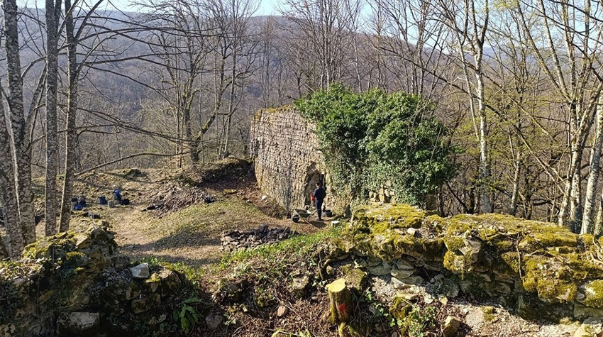
The first results have already provided the most detailed insight so far into the structure of the fortification, as well as its potential for further research. Current excavations, according to archaeologist Dušan Kojić, are focused on collecting data from earlier digs.
“The new approach will help us design a strategy for future excavations and research of this important archaeological site. We will be able to determine the appearance of the fortress, its construction, interior, and surroundings. By using modern technologies, we will also identify the phases of its construction and life within the fortress,” Kojić explained.
The project is being carried out in cooperation with the Archaeological Institute in Belgrade.
The study of the fortress—of which the western wall and the main donjon tower, once the last line of defense, have been preserved—is important, according to Belgrade-based archaeologist Uglješa Vojvodić. It offers new insights into defense systems and the role of the fortification in resisting Ottoman incursions.
Vrbaški Grad, situated on a cliff at an altitude of 285 meters along the Gradiška–Mrakovica road, was first mentioned in 1244 in a charter issued by Hungarian King Bela IV, where it is described as the administrative center of the Vrbas county.
Historical records also show that in 1398 the Holy Roman Emperor Sigismund visited the site, highlighting its importance at the time. The region was ruled by the Babonić noble family.
The fortress, about 50 meters long, stands atop Pavetnjak Hill near Gornji Podgradci. According to historical sources, it was captured by the Ottomans in 1537, when commander Andrija Radulović, unable to defend it any longer, set it on fire and abandoned it. The site was never rebuilt or resettled.
Today, parts of the western wall remain, measuring 21 meters in length and up to five meters in height. Openings along the wall once supported wooden beams used by the defenders.
Vrbaški Grad, together with the Church of St. George, has been declared a national monument of Bosnia and Herzegovina.
At the foot of the fortress, on its southern side, archaeologists discovered in 2016 an impressive medieval church dedicated to St. George. The structure, oriented east–west and featuring a semicircular apse, is considered one of the largest churches of its time in the wider region.
Built of both rough and finely cut stone bound with lime mortar, the church also features brick flooring. Its architectural style combines Romanesque and Gothic elements, reflecting the influence of builders from Western regions and Dalmatia.
Research has also uncovered parts of structural supports first documented in 1936, as well as a silver coin from the second half of the 15th century belonging to Hungarian-Croatian King Matthias Corvinus, one of the most powerful rulers of his era.
A settlement developed near the fortress and church, believed to be the origin of present-day Gornji Podgradci. By the late Ottoman period, in 1855, a water-powered sawmill was established in the area, employing workers from across the Austro-Hungarian Empire and contributing to the growth of the local population and settlement.

Join our
Viber Community
SUMMER BOOM FOR HOLIDAY HOMES IN SRPSKA, PRICES REACH KM 2,500 PER DAY
SECOND DERVENTA SAVA REGATTA DELIGHTS PARTICIPANTS
SAČIJADA BRINGS TOGETHER TRADITIONAL CUISINE LOVERS ON THE BANKS OF THE PLIVA RIVER
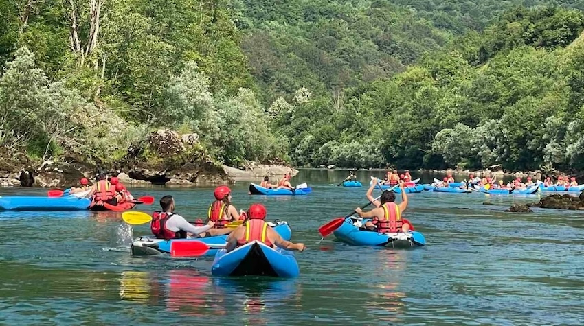
MORE THAN 300 PARTICIPANTS SET SAIL ON THE DRINA: FOČA HOSTS THE "DRINA ADVENTURE" REGATTA
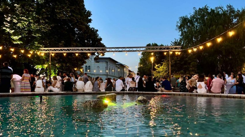
PHOTO WALK THROUGH THE “WINE PARK” IN GRADIŠKA
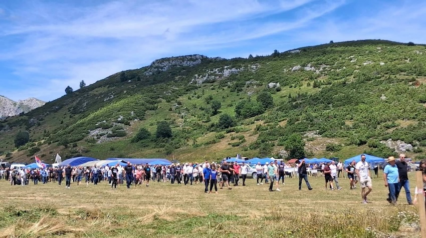
KALINOVIK OLYMPICS BRING TOGETHER TRADITION, CHIVALRIC GAMES AND THE BEST SCYTHE MOWERS
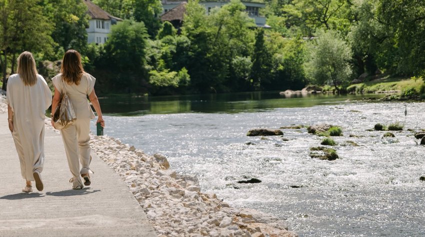
PHOTO WALK ALONG BANJA LUKA'S NEW VRBAS RIVERSIDE PROMENADE
MORE THAN 300 PARTICIPANTS SET SAIL ON THE DRINA: FOČA HOSTS THE "DRINA ADVENTURE" REGATTA

TOK FEST BRINGS RURAL TOURISM, HUNTING AND FISHING FAIR TO KRAJINA
PHOTO WALK THROUGH THE “WINE PARK” IN GRADIŠKA


 The situation at the border crossings